![]()
Page 12a
Our trip to Roy, Utah
- Denver to Grand Junction
- Grand Junction to Roy
- Antelope Island and Hill Aircraft Museum
- Bear Lake, Utah day trip
- Roy, Utah to West Yellowstone, Wyoming
- West Yellowstone, Montana to Deadwood, South Dakota
- Deadwood, South Dakota to Mason City, Iowa
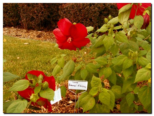
Our trip began at 6:00 AM as we loaded the car and headed south on I-35. Our first stop was in Des Moines for a mid-morning break and breakfast at one of our favorite places, Cracker Barrel. Sandy takes a bit of teasing about stopping here, since it is at times difficult to get her out of the gift shop before and after the meal. But this trip I had more trouble getting her into the restaurant as the front sidewalk was lined with this very unique flower. As you can see it is tagged with the name, "Luna Perennial Hibiscus". The red bloom is nearly 8" in diameter on 18" high stems. So this was the first picture of the day.
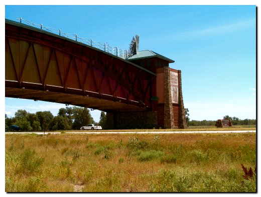
We drove straight through to Kearney, Nebraska where our first night was planned. We have not had an opportunity to visit the "Great Platte River Road" Archway Monument (www.archway.org) that was built over I-80.
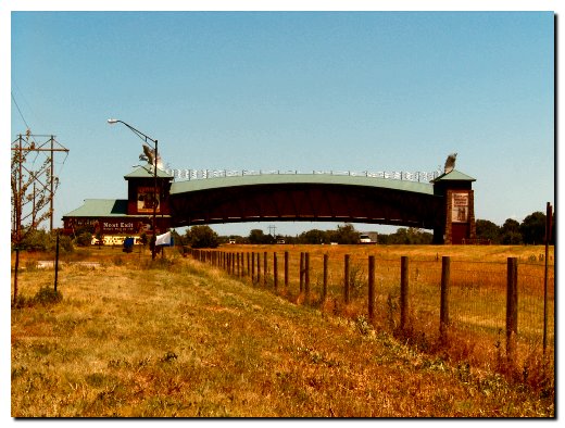
It is not the goal of our travel log to act as an entertainment critic, but we must say that a visit to the archway left us wondering about the price of admission. Inside this very unique structure period dressed hosts directed us up an escalator after paying $10.00 each. We found many very interesting displays and dioramas, but other than that there wasn’t much to do except walk across (above) the interstate and return. We are not sorry we stopped here, but will make this a one-time visit. The one point of interest, although glossed over by the archway, was the fact that the 1849 Gold Rush travelers would have crossed Nebraska at about this point. Several of the Breyfogle ancestors were among the travelers on the Gold Rush so we did spend a moment looking out a window to the west wondering just what it must have been like to travel this country so long ago.
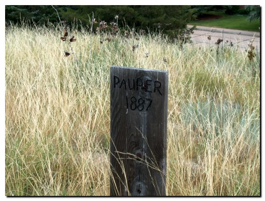
Our second day on the road found us leaving the motel by 6:30 AM to head west on I-80 headed for Colorado. We wanted an early start so we had time to visit with Dale when we arrived in Fort Collins. We did not make any hard and fast plans before leaving about what to stop and look at on the way, but Sandy found a couple interesting places on this leg of our trip. The first stop was in Ogallala, Nebraska. We found Boot Hill, an 1880’s cemetery that really did set atop a hill. We parked below the hill and climbed a couple flights of steps to the top of the hill where we found reproduction wood grave markers.
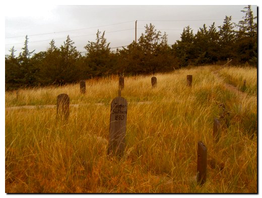
The information at the base of the hill indicated that most of the gravesites were from the 1880’s, with some of them moved to other locations at a later date. The information also indicated that the remaining gravesites are for the unclaimed and unknown, and we suspect that the names on the grave markers may not necessarily represent factual information, but we thought that the graveyard probably looked as it would have in the 1880’s with the grasses standing tall around the graves.
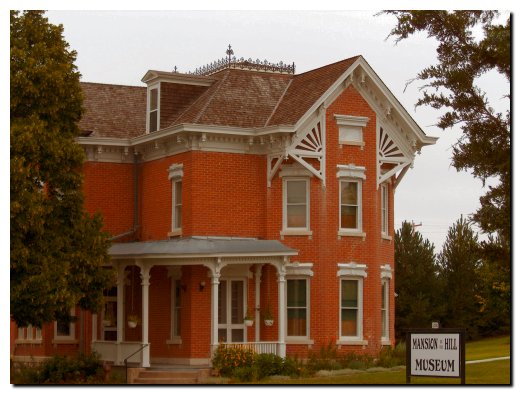
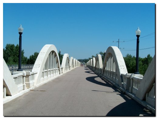
Our next stop was just that, a quick stop before heading west again. This Victorian mansion in Ogallala is now called a Mansion on the Hill Museum. We arrived before they opened so we took a picture and headed back for I-80. Our next stop was after we left I-80 and picked up I-76 in Colorado. Sandy found a travel listing for the Rainbow Arch Bridge in Fort Morgan, Colorado, one of Colorado’s longest bridges. This old reinforced concrete bridge was rescued from collapse in the late 1990’s and is now a walking bridge over the South Platte River.
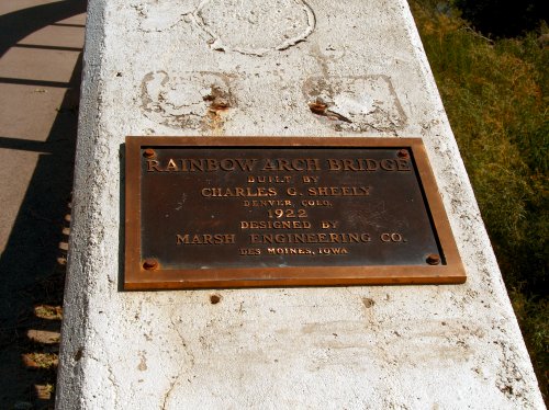
This bridge was designed by a firm in Des Moines, IA and was built in 1922. There is a modern bridge that parallels this bridge for regular vehicle transportation.
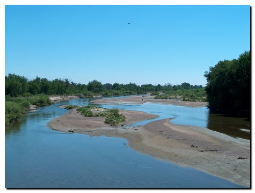
The picture below is looking east at the South Platte River from the Rainbow Arch Bridge. We saw other pictures of the bridge taken from down river with the river at flood stage so we realize that the river is pretty low at this time of the year.
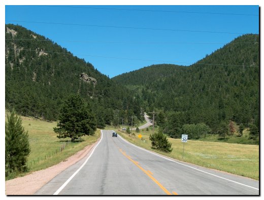
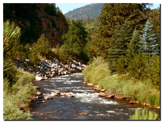
We arrived in Windsor, Colorado about noon and checked into the motel. We called my brother Dale and made plans to get together for an afternoon visit and drive around the Front Range area. We started our drive by traveling through Rist Canyon from Fort Collins. The picture below is looking back over the canyon we just traveled through. We then wound along a road to end up in the Poudre Canyon. This is one of our favorite locations in the Northern Rockies.
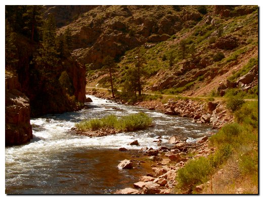
The picture above is typical of the landscape we enjoyed on our drive up and then back down the canyon. The water is running high for this time of the year and Dale reports that everything is pretty green for this late in the summer. The only thing that marred our trip is an accident that slowed traffic in the canyon. We did not see much except rescue vehicles, but later on the news we saw that it was a woman pulled from a car that had crashed over the cliff into the river below (she did not survive and the investigation continues). We returned to Fort Collins later in the afternoon and after dinner dropped Dale at home and headed back to the motel.
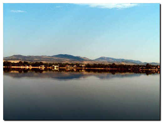
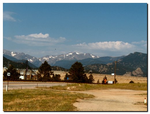
Our third day on the road started a little later than the first two. We did not leave the motel in Windsor until about 8:00 AM. We drove south on I-25 and took the State Highway 34 exit. We followed this west to pick up what is called the Peak-to-Peak Scenic Highway. This drive uses several highways and travels south from Estes Park to Black Hawk, CO and is billed as the oldest scenic highway in Colorado. The picture below shows our first brief stop, Loveland Lake in Loveland, CO.
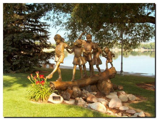
Although we can’t find this park on the city’s website it was marked South Shore Park and featured several bronze sculptures. We like this one, called The Crossing (for obvious reasons) and a local family donated it to the city.
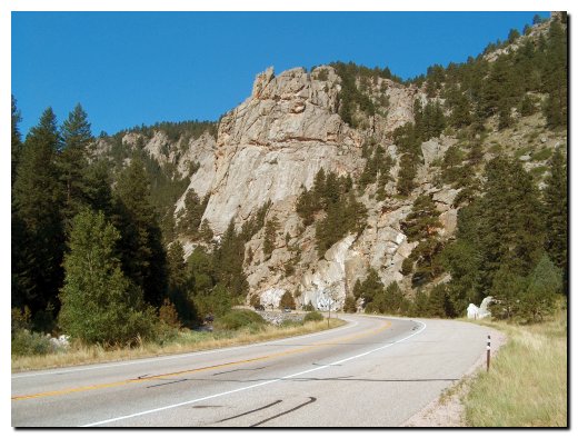
As we left Loveland we entered the Big Thompson Canyon and what a breathtaking drive this was. We like the rugged nature of the Poudre River Canyon and find the Big Thompson to be more developed and cluttered with housing and businesses, but there are stretches where you see nothing but the road and rock cliffs.
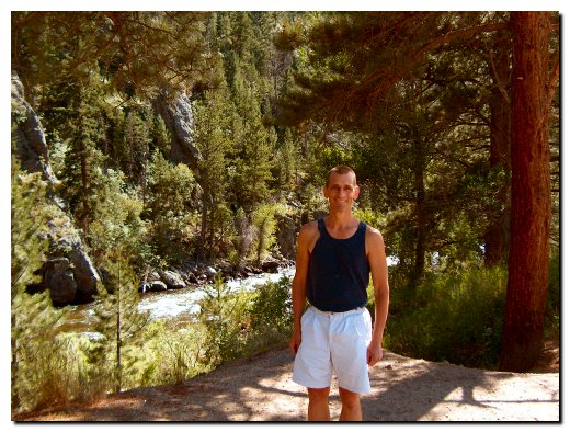
As interesting as the rock cliffs are we are always drawn to the rushing water in the river itself. I complained that most of the good pictures were left to others, as it was difficult to pull over with the heavy traffic we had along the way. But as you can see, we did find a place to pull over for a river picture.
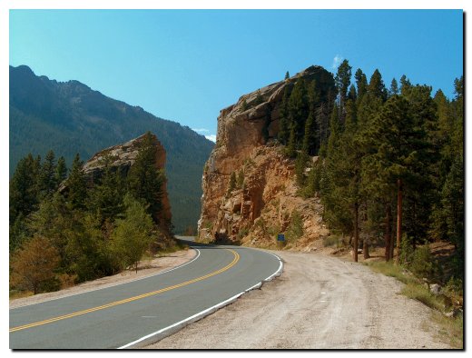
Then all of a sudden we were out of the canyon and entering Estes Park. I pulled over to take this picture since I was very impressed with the sudden change in the view.
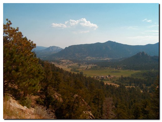
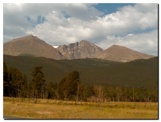
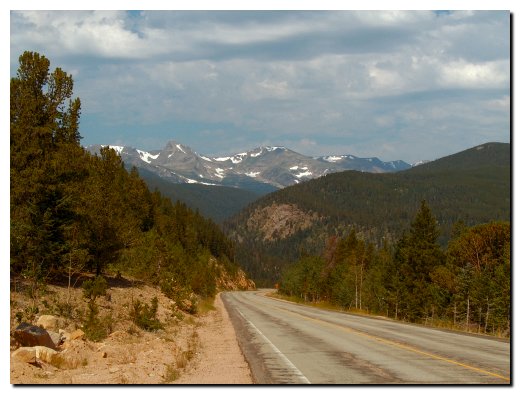
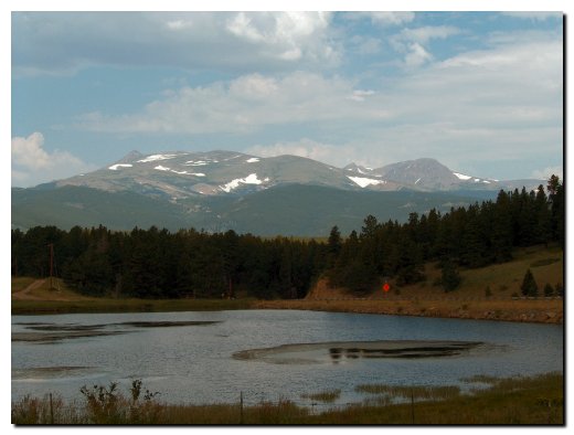
Once we started along the Peak-to-Peak Scenic Highway it was difficult not to pull off around every corner as we were greeted with beautiful mountain scenery. We offer the next series of pictures as a small example of what we saw.
We will stop here to mention that the picture below is Longs Peak. This peak is very recognizable, but we had help with a sign that pointed to it. This spot also marked the site of an early homestead but there wasn’t anything to mark its site except a bronze plaque.
We stopped in a small town called Nederland and had a late morning beverage break (just coffee and coke) at the Pink Flamingo. This exotic sounding facility had an open patio where we sat enjoying the dry air and fresh breeze. It was still warm but not as hot as it would be later in the day when we dropped 3000 feet in elevation. We did not take a picture of this watering hole.
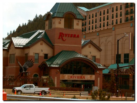
We did have a bit of a surprise when we entered the town of Black Hawk and Central City. We were unaware that it is becoming a gambling and casino hot spot. And only after reading the travel guides did we find out more about this city wedged between two canyon walls. This town started as a gold boom town in the 1870's and is Often referred to as the richest square mile in the world based on the number of gold mines in this area. Gambling was legalized in 1992 and by the looks of construction it will be a couple years before every square foot of building space is filled with huge casinos. The traffic was terrible and the construction was going on all around us, so Sandy snapped the picture below as we waited for a flagman to wave us along the one way traffic in the construction area.
Things got a little tense when we left Black Hawk and found the end of our scenic highway closed for road construction. We took an alternate route and ended up twisted up and lost somewhere in the suburbs west of Denver. But we kept a cool head and juggled several maps and Internet driving instructions trying to find the hotel where my meeting is to be held. In the end Sandy used a picture of the Omni Hotel she downloaded from their website in preparation of this trip to help us find our way. Once we saw the facility on the horizon we twisted around on strange roads until we started seeing signs pointing us in the right direction. And the picture below shows the hotel where my meeting will be held.
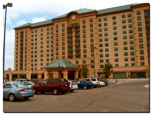
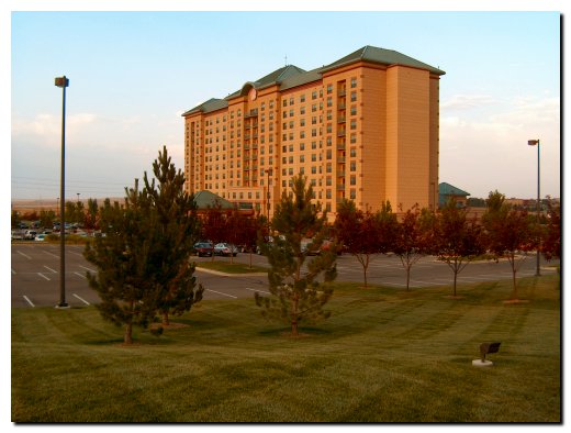
While I was off to start my meeting with a dinner gathering Sandy went for a walk around the property and took this better picture of the hotel.
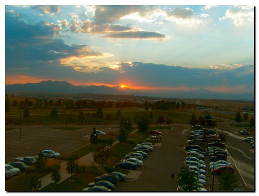
The last picture on our third day out is another that Sandy took. We are always drawn to sunsets and this one caught her eye. It was taken from our fifth floor room and turned out well even though it was taken through the window glass. We will take a day off from the heavy-duty travel and sight seeing to tend to work. We will depart here on Friday and unless Sandy takes pictures on Thursday we will skip a day from updating this site.