|
|
Page 26r |
|
Our Big Trip Across the Western US - September 2015
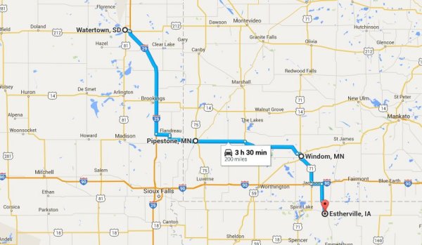
Today was our final sightseeing day of our trip. We will have a short drive home on Monday after a stay in our apartment in Estherville. With a short drive planned for today we set out a little later than past days and instead of letting the Garmin plan the route we mapped it out so we could take a route off the interstate. We took I-29 south to South Dakota Route 22 west until we arrived at Canby, MN, then south on US Highway 75 to Pipestone, MN. Canby is a small town of about 1800 people and there is a connection to the Breyfogle family there. John Joseph Breyfogle settled here with his family in the 1950’s. He is Dan’s 1st cousin, removed three times. So not a close relative and one we have never met, but we at least wanted to put a picture with the family connection. This is a picture of part of the downtown business district. 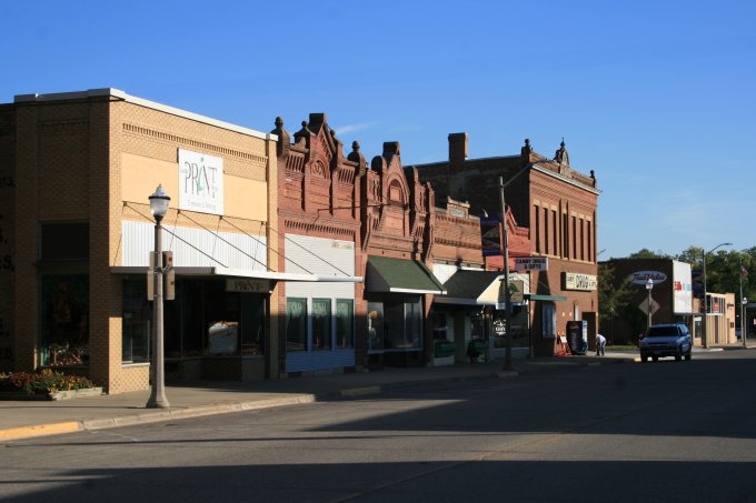
With our recent visit to Fargo and seeing their restored theater this old marquee caught our eye, and the theater appears to be still in use. 
We did not have much time to research our stop in Canby so did not attempt to find headstones in the local cemetery but did find a discussion of the Lund-Hoel House that was built in 1891. It was the talk of the town back when it was constructed and we are sure it remains a great asset to the community. Since our goal was to get to Pipestone we left town without further investigation of this town. 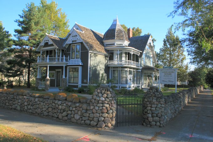
We arrived in Pipestone and drove directly to the Pipestone National Monument where we viewed the “Three Maidens” near the entrance. These three very large granite rocks were deposited here during the last ice age and are not native to this area. They are considered sacred by the Native Americans and offerings or gifts are often found near them. 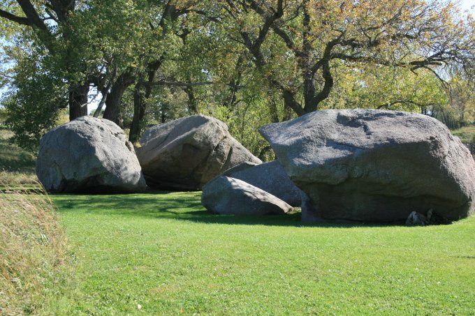
We visited the interpretative center that contains a lot of displays and information about the quarries found on this site and the Native Americans that have been working them for over 3000 years. We last visited this national monument back in the 1980’s when the boys were in Cub Scouts and neither of us remembers such a grand display. The ľ mile trail around the site provided us with views of the active and inactive quarries. This one is still being worked by the registered workers, all of which are Native American. All work is by hand tools only. 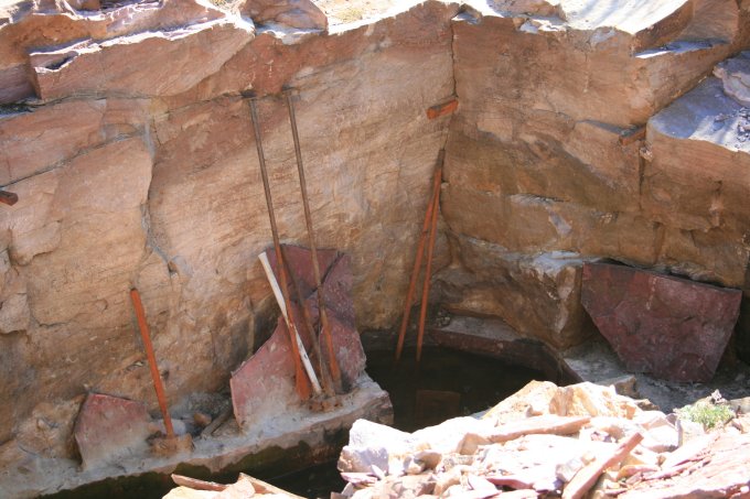
As we retraced our steps from the quarry walk we headed around the loop trail. At one point a sign pointed to the camping location for Inkpaduta, the Native American war chief that led the raid near Spirit Lake, IA and took Abigail Gardner Sharp and several others captive. This was his campsite on his retreat from northern Iowa after his 1857 raid. Turning our back on the campsite area we could see the red rocky cliffs that are very near the campsite. 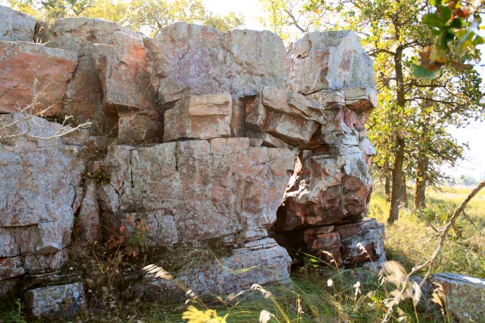
These cliffs offer a very clear look at the layers of Sioux Quartzite that are found covering the pipestone (known as Catlinite). There is a trail right next to the cliffs and there was a set of steps up to view the Oracle, which is a face shaped rock formation that legend says provides wisdom to all travelers that view him. 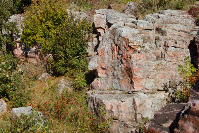
The Winnewissa Falls is located between these cliffs and is fed by the Pipestone Creek. There is a footbridge to walk across the water and steep stairs to climb to the top. We opted not to climb the stairs because we felt the view from the bottom would be much more impressive. 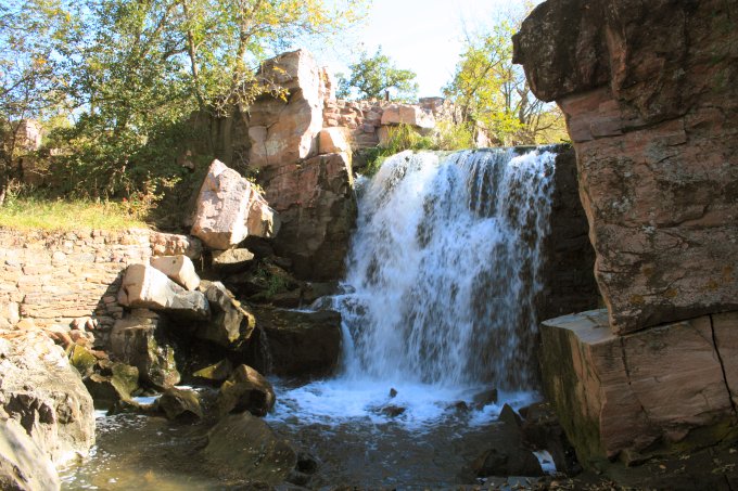
Very near the falls is “Leaping Rock” and was used as a test of valor by young Native American men in the days before white settlers arrived to this area. It is also known as “Old Stone Face Rock” and early explorers noticed arrows atop the rock and were told by natives that the arrows were planted by those who leapt onto the rock. 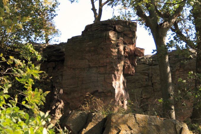
During a surveying exploration in 1838 Joseph Nicollet, a mathematician and scientist, left an inscription on the rock overlooking the leaping rock to mark his passage through this area. The inscription is difficult to see in the shadows of the trees but is carved deep enough to stand the wreathing over the ages. 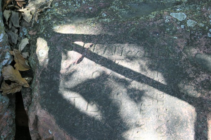
Pipestone Creek meanders through the prairie and forms a pond near the visitor’s center. This was once a swampy area but Native Americans dammed it in the 1930’s to provide a swimming hole for their children as the adults worked the quarries. 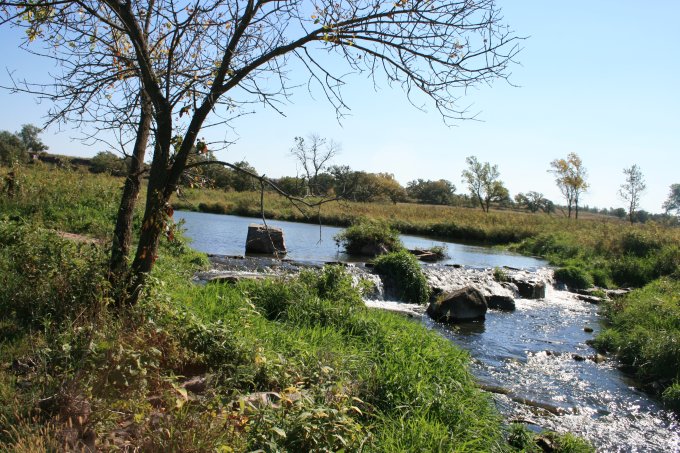
One of our primary goals in visiting this National Monument was to view the pipestone carving demonstrations that occur every day during May through October. We watched two workers before walking the trail and when we returned they were taking a lunch break so we took pictures of their tools and work areas. They use a variety of knives, rasps, and sandpaper to cut, shape, and smooth the stone. 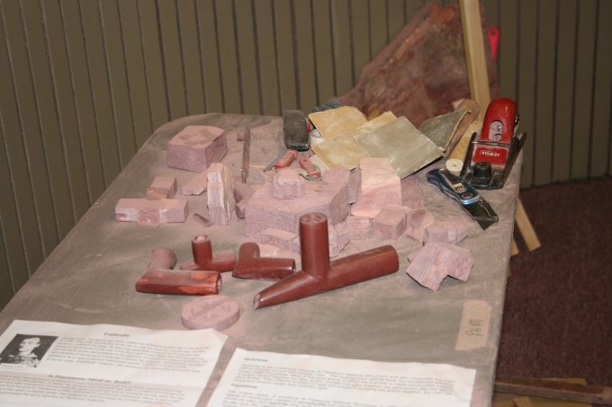
Leaving the monument we drove through the community of Pipestone and saw many buildings featuring the Sioux Quartzite including this large building built in 1887 and has the name Calumet at the top. There appear to be several businesses on the ground floor with the upper floors vacant. 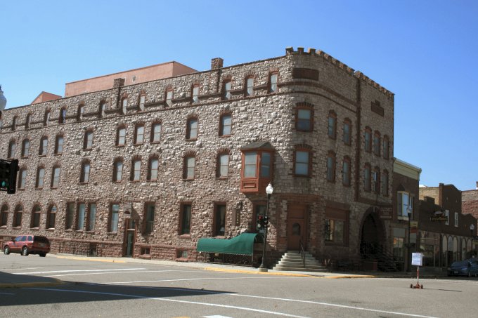
The remainder of our travel took us south on US Highway 75 to Iowa Highway 9. As much as we enjoyed our travel it was good to be back on familiar ground. We noticed a lot of soy bean harvesting starting and the corn is drying down nicely. Now if we just knew what condition our lawn is in without being mowed for three weeks. If you do not see a menu on the left click here to go to our home page. |