|
|
|
|
September 18, 2009
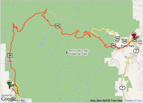
Total distance traveled - 44 miles
GPS data recorded on this day can be seen at Garmin Connect
After a very pleasant night of camping at Winding River Resort, we began our preparation for the next leg of bike tour. Although during the night we were woken up by the very persistent bugling of a bull elk. The elk started his bugling after midnight, and he continued into the very early hours of the morning. Even though we heard the bugling elk periodically through the night, it was possible to get some sleep before sunrise. Other than the sounds of the rut, the campground was very quiet, due to the fact that there were only a few other campers within eyesight of our campsite.
Today our bike ride takes us over Trail Ridge Road, the highest continuous highway in the United States. From Winding River Resort (el. 8700 ft.), we will be climbing to the maximum elevation of 12,183 feet at Rock Cut. More than eight miles of our ride will be well above tree line at an elevation above 11,000 feet. Although, Trail Ridge Road reaches the highest point on our tour, the difficulty negotiating it on a bicycle is relatively easily because the roadway was designed with ruling grade generally less that 5% and never exceeding 7%. However, the thinner air and the long duration of riding at higher elevation, can adversely effect a bike riders stamina.
After breaking camp on getting back on the bikes, we rode back to HWY 34 and then stopped at the the west entrance to Rocky Mountain National Park to pay the $10 bicycle toll fee, for each of us. We then noticed that Aspen Glen Campground had no vacancies, which would mean that we would have to stay at a private campground near Estes Park, tonight.
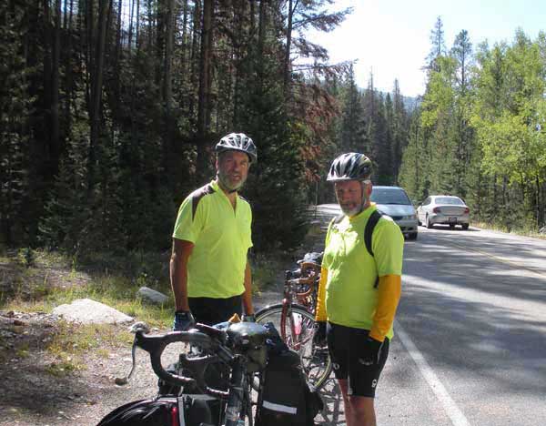
After gaining access to the park, we started out on what would be a very exhilarating and scenic ride. We soon met another bike tourist, who came up from behind us. The picture, above, is of Doug and Charlie Niebling while we were taking a short break. Charlie, who is from Boscawen, New Hampshire, started his tour from the Oregon coast, and would finish his tour when arriving in Boulder, Colorado, later today. Doug and I greatly enjoyed riding and conversing with Charlie until we finally parted at the Alpine Visitor Center, later in the day.
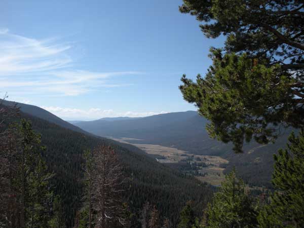
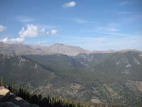
The picture, above, was taken at Fairview Curve. The Kawuneeche Valley is seen streaking out toward the south to Grand Lake. The Colorado river flows through this beautiful valley, from which it originates at La Poudre Pass about 9.5 miles north of Grand lake, within Rocky Mountain National park.
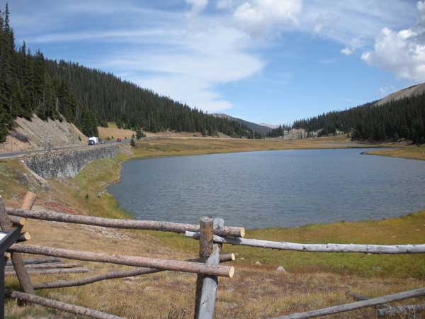
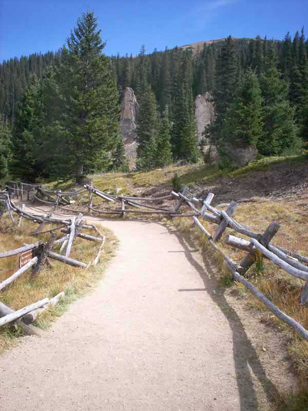
The two previous pictures, were taken at Milner Pass, our second crossing of the "Great Divide". The first of the two pictures is of Poudre Lake, and the second picture shows the trail head of the Old Fall River Road that lead to the summit of Fall River Pass. The Picture, below, is of Poudre Creek, which was taken at another pull out, further on up the road.
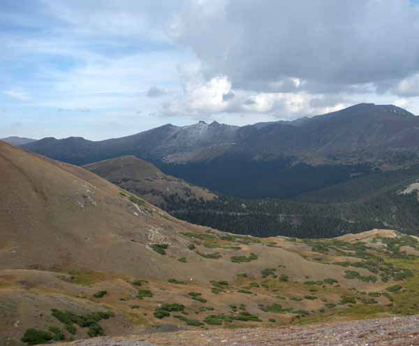
We arrived at the Alpine Visitors Center, and we went inside for lunch and and drank some hot tea. The weather changed, while we ate our lunch, and it started to rain outside. After lunch, we noticed that some snow had fallen on the higher mountain peaks, as can be seen in this picture.
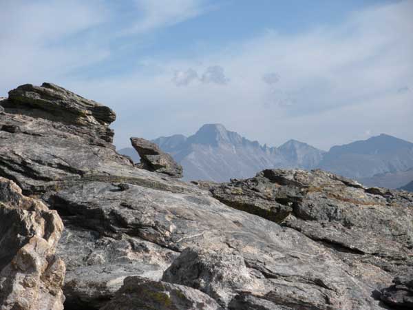
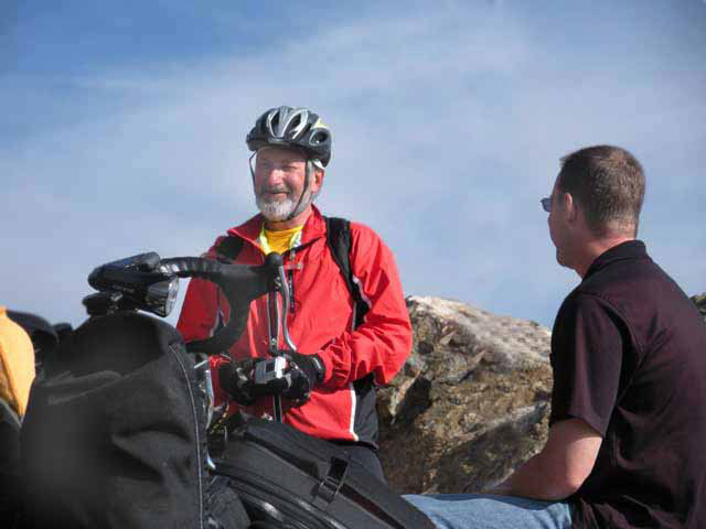
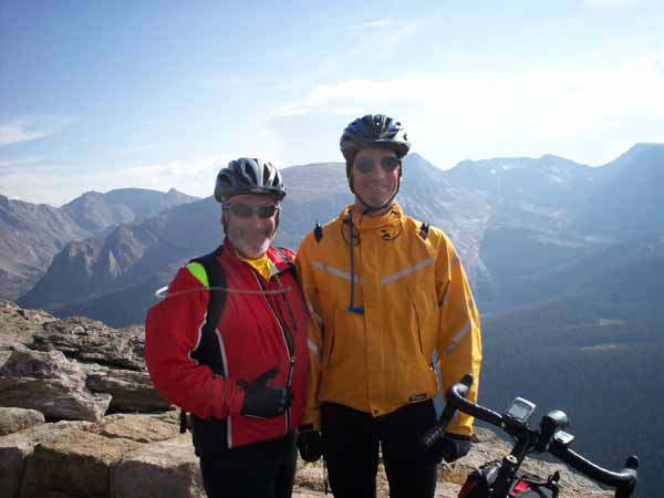
The next three pictures, were taken at Rock Cut. The first picture is looking east towards the Gore Range, with Longs Peak (el. 14,259 ft.), the highest peak in Rocky Mountain National Park; appearing, in the distance, with its large flat-topped summit. The second picture shows Doug talking to a man who is a bicycle enthusiast, from Iowa. They were engaged in a stimulating conversation regarding bicycle touring in the Rocky Mountains of Colorado. The third picture, is of us gleaming with the joy of successfully ascending to the highest point of the tour. The ride from this point, is predominantly downhill, for the rest of the afternoon.
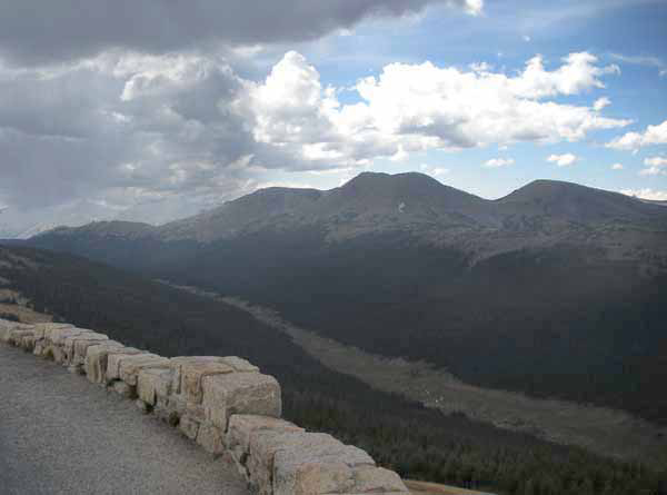
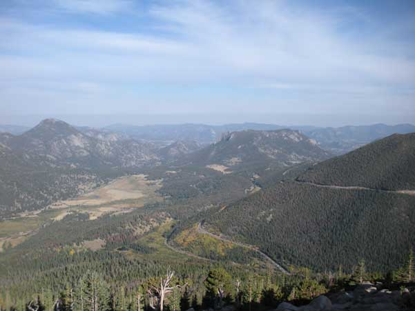
The final two pictures were taken at Rainbow Curve, after the descent from Rock Cut. This pullout is a popular overlook for tourists because of its scenic quality of viewing the Front Range mountains that border Rocky Mountain Park. In the first picture Trail Ridge Road can be seen, on the right, winding its way down the mountain side into Hidden Valley. The final picture is looking in a northwesterly direction towards Rock Cut.
Our next task was to try to find a campground near Estes Park. It was getting late, so our need to find a place to rest was great. After some confusion trying to locate a campground from a cryptic map that we received at the east park entrance, we decided to stay at Elk Meadow Lodge and RV Resort. At this resort we would setup camp for our last night out, and tomorrow ride our bikes back to Fort Collins.
More pictures and tour information can be seen on the next page, Day-6.
Return to Early Fall Adventure Front Page
|
|
